

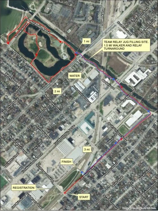
2027 Run/Walk Race Map
This map highlights the official course routes for the 2027 Run/Walk events, including the 5K Run, 5K Walk, 1.5-Mile Fun Walk, and Team Relay. All routes start and finish near the McPike Park area, with clearly marked paths, mileage indicators, and support locations.
Key features on the map include:
Start/Finish Area: Located near East Main Street, next to the registration zone.
Water Station: Positioned near mile 1.5 for hydration support.
Relay Jug Filling Site: A designated stop for the Team Relay to simulate the water collection experience in rural Sub-Saharan Africa. This also serves as the turnaround point for the 1.5-mile walkers.
Route Highlights: The course loops through city streets and along park trails, with directional arrows guiding all participants through each section.
Participants are encouraged to review the map before race day to get familiar with the course and key points of interest. Volunteers and signage will be on-site to support navigation.